 BGS Data Catalogue
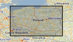
Polish Geological Institute - National Research Institute
Type of resources
Topics
Keywords
Contact for the resource
Provided by
Years
Formats
Representation types
Update frequencies
-
The dataset contains details of field collection of test soil gas samples with use of Supel Inert Foil gas sampling bags and the results of methane and ethane measurements performed in order to validate a methodology of soil gas sampling and analysis. The dataset is not intended to be used for any site characterisation, sampling sites were chosen based on high probability of occurrence of measureable methane content in soil gas. Furthermore, the data will be used for formal procedure to obtain the methodology accreditation from the Polish Centre for Accreditation (PCA). The dataset might be used as a set of results of the analytical methodology in future field experimental works. However measurement data are related to particular soil types and beside validation/inter-comparison purpose are not reusable. The dataset was created within SECURe project (Subsurface Evaluation of CCS and Unconventional Risks) - https://www.securegeoenergy.eu/. This project has received funding from the European Union’s Horizon 2020 research and innovation programme under grant agreement No 764531
-

The dataset is on characterization of shale gas wells for well integrity simulations. Basing on raw data and other information pertaining to two shale gas wells, acquired from Polish Oil and Gas Company (PGNiG) input to the well integrity simulations carried out by TNO was supplied by PIG-PIB. The input consisted in elaborating generalized models of the wells and their surroundings as wells as characterization of the target formations. Well construction schemes including the production casing sizes and depths and generalized lithostratigraphy of the geological formations in question were composed. Raw data acquired from PGNiG included wireline logging data (and interpretation results) together with results of laboratory measurements of drill core samples (e.g., on geomechanical properties). Regarding characterization of the target formations the most important information created were distributions of in situ stresses within particular formations in both wells, assessed on the base of results of wireline, density logging (vertical stress – based on weight of the overburden at a certain depth) and laboratory measurements of geomechanical parameters (horizontal stress – based on pressure values measured within rock sample in tri-axial chamber at reservoir conditions). Temperature values within formations in question were assessed assuming local geothermal gradient and information from PGNiG reports. The dataset was created within SECURe project (Subsurface Evaluation of CCS and Unconventional Risks) - https://www.securegeoenergy.eu/. This project has received funding from the European Union’s Horizon 2020 research and innovation programme under grant agreement No 764531
-

The dataset contains condensed results of seismic refraction survey, that can be regarded as “hard data”. Data files Syczyn-1_P.ASC and Syczyn-1_S.ASC represents tables obtained for line Syczyn-1, wave P and wave S respectively; Data files Syczyn-2_P.ASC and Syczyn-2_S.ASC represents tables obtained for line Syczyn-1, wave P and wave S respectively. Each file contains 4 columns: Record No. – sequential record identifier; Source location – distance from the beginning of the line to the (current) source point (in meters); Receiver location – distance from the beginning of the line to the given receiver (in meters); First Break – delay time between emission of the wave to its arrival at the given receiver point (seconds). Dataset is formatted in simple table, that can be imported to other seismic software for modelling velocity field. Different computing algorithms generate slightly different velocity models, so it can be useful to have hard data for comparison.
-

The dataset contains details of field collection of groundwater samples with use of different water intake devices and the measurement results of gaseous compounds (methane) obtained during analytical method validation performed in order to develop a methodology of groundwater sampling for analysis of dissolved gases. The dataset is not intended to be used for any site characterisation. Sampling sites were chosen based on high probability of occurrence of measureable methane content in groundwater. Furthermore, the data will be used for formal procedure to obtain the methodology accreditation from the Polish Centre for Accreditation (PCA). The dataset was created within SECURe project (Subsurface Evaluation of CCS and Unconventional Risks) - https://www.securegeoenergy.eu/. This project has received funding from the European Union’s Horizon 2020 research and innovation programme under grant agreement No 764531
-

The dataset contains results of field measurements (temperature, pH, conductivity, redox potential, oxygen content) of groundwater and samples collection details as well as the results of laboratory analysis of the set of dissolved and gaseous parameters performed within the environmental monitoring campaign on 3 Polish shale gas sites where exploration activities including hydraulic fracturing were conducted in 2010-2016 period.
-
The dataset contains details of field collection of soil gas samples with use of Supel Inert Foil gas sampling bags and the results of methane, ethane, carbon dioxide measurements performed within the environmental monitoring campaign in vicinity of abandoned boreholes on 2 Polish shale gas exploration sites where operations including hydraulic fracturing were conducted in 2010-2016 period.
-

Data contain reference measurements of methane concentration in soil gas samples for storage tests in sampling methodology evaluation and results of field measurements as well as laboratory tests of methane and carbon dioxide conducted on parallel to main set samples collected for monitoring observations on post-exploration shale gas sites in Poland for quality check and control.
-

The dataset is on analyses on formation confinement based on available results of laboratory geochemical measurements of brine samples for several field sites (shale wells, acidic gas storage within a depleted gas field and a saline aquifer structure – a possible CO2 storage site). The goal of these analyses was to assess the presence of relic brine within reservoirs/aquifers in question or brine exchange between reservoirs/aquifers within these sites. Results of these analyses can be used to evaluate caprock integrity for they could be indirect evidence of possible migration paths (faults, fractures) and hence possible leaks within the site currently, in the not-too-distant geological past, or no migration or fluid exchange at all (relic brine). The dataset was created within SECURe project (Subsurface Evaluation of CCS and Unconventional Risks) - https://www.securegeoenergy.eu/. This project has received funding from the European Union’s Horizon 2020 research and innovation programme under grant agreement No 764531